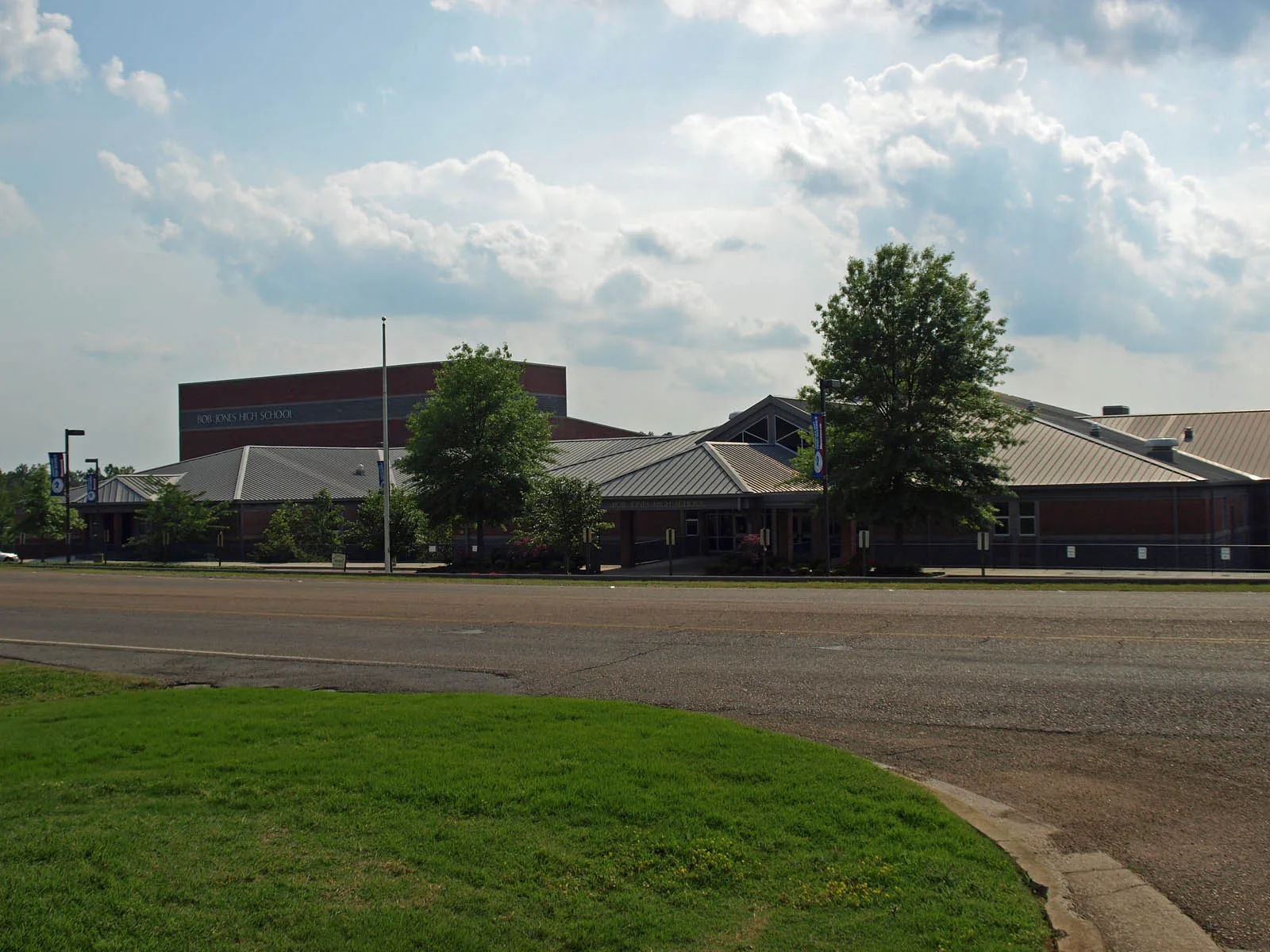
North-central Madison around Gillespie Road is split between Bob Jones High and James Clemens High zones, roughly at Balch Road. ZIP 35758: $376,539.
Last checked Oct. 17, 2026. Sources: the City of Madison’s Madison on Track 2045 Comprehensive Plan (PDF, amended June 9, 2025) and greenways and trails map; Madison City Schools’ 2026-27 School Zone Locator; the Alabama State Department of Education’s state report card for 2025; Zillow Research; the Census Bureau; and OpenStreetMap.
North-central Madison, between Browns Ferry Road and U.S. 72, is a broad block of neighborhoods cut east and west by Gillespie Road and north and south by Hughes Road, Wall Triana Highway and Balch Road. It holds five public schools, among them Bob Jones High, the district’s pre-K center and about 10 small city parks. The comprehensive plan marks the corner of Wall Triana Highway and U.S. 72 as a Key Opportunity Area for more housing, though much of that corner lies outside the city.
What this means for you
- Zoned high school: Bob Jones High, 650 Hughes Road (2025 state report card: 86), east of about Balch Road; James Clemens High (88) west of it.
- Home value: $376,539 in ZIP 35758 in September 2026, according to the Zillow Home Value Index.
- Nearest interstate exit: I-565 exit 9 (Madison Boulevard and Wall Triana Highway), about 4.4 miles by road.
Part of our Madison neighborhoods guide.
Where it is
For this guide the area runs from Hughes Road west to County Line Road, and from Browns Ferry Road north to the city limit at U.S. 72. It is in Madison County; the Census Bureau places the city part in ZIP code 35758, while some unincorporated land near U.S. 72 uses 35757, so the mailing address is not proof a home is inside Madison.
The plan says the city’s newer neighborhoods to the north and west were built in large blocks with cul-de-sacs and few links between them, which pushes traffic onto a few connector streets. It also notes that Bob Jones High sits on a major street without sidewalk or greenway links to the neighborhoods nearby that have sidewalks.
Schools
Scores are each school’s overall score on the 2025 state report card (the 2024-25 school year).
| Level | School | Address | 2025 score |
|---|---|---|---|
| Elementary | Midtown Elementary | 140 Coefer Blvd. | 96 |
| Elementary | Columbia Elementary | 667 Balch Road | 97 |
| Elementary | Rainbow Elementary | 50 Nance Road | 97 |
| Middle | Discovery Middle | 1304 Hughes Road | 94 |
| Middle | Liberty Middle | 281 Dock Murphy Drive | 93 |
| High | Bob Jones High | 650 Hughes Road | 86 |
| High | James Clemens High | 11306 County Line Road | 88 |
This area is split. In Madison City Schools’ 2026-27 zone layer, about seven-tenths of the land, mostly east of Balch Road, is zoned for Discovery Middle and Bob Jones High; the land west of it toward County Line Road is zoned for Liberty Middle and James Clemens High. For elementary school, Columbia and Midtown each take about a third, Rainbow Elementary takes the northeast toward U.S. 72, and a few study areas go to Madison (97) or Mill Creek (97). Midtown, Columbia, Liberty, Bob Jones and the district’s pre-K center at 4976 Wall Triana Highway are all inside the area, and Discovery Middle is on Hughes Road at its east edge. Check one address with the School Zone Locator or call the Central Office, 256-464-8370. More in our schools guide.
Home values
The typical home value in ZIP code 35758 was $376,539 in September 2026, up 1.4% from $371,281 in September 2025, according to the Zillow Home Value Index. The index is a modeled typical value for the middle third of homes, not a sale price, and 35758 covers most of Madison, so it is not a figure for this area alone. ZIP 35757, north of U.S. 72, was $348,989. The City of Madison figure was $376,486, up 0.9%. More in our home prices and property taxes guides.
Parks and trails
Neighborhood parks listed in the comprehensive plan’s park inventory include:
- Leathertree Park, 221 Gillespie Road.
- Mill Creek Park, 141 Teal Park Lane, and Abbington Downs Park, 135 Manningham Drive.
- Collinwood Park, 235 Jarrett Lane, and Windsor Parke Park, 183 Amsterdam Place.
- West Highlands Park, 439 Clydebank Drive, and Brass Oak Park, 126 Jay Drive.
- Joe Phillips Park, 154 Joe Phillips Road, Silver Creek Park, 108 Donash Circle, and Homestead Park, 201 Prairie Drive.
The north end of the Mill Creek Greenway has parking at Browns Ferry Road and Balch Road, according to the city’s trail map. Neighborhood parks are open from sunup to 30 minutes after sunset. More in our parks and trails guide.
Getting around
- Interstate: I-565 exit 9 (Madison Boulevard and Wall Triana Highway), about 4.4 miles by road from Gillespie Road at Balch Road. U.S. 72 runs along the north edge.
- City Hall: about 3.3 miles by road to 100 Hughes Road.
- Airport: about 8.6 miles by road to Huntsville International Airport.
Distances are measured on the OpenStreetMap road network with the OSRM routing engine; they are distances, not drive times. Madison has no fixed-route city bus; see our getting around guide.
Groceries and everyday stores
From OpenStreetMap:
- Publix, 350 Hughes Road, and Kroger, 4579 Wall Triana Highway, at the south edge.
- Walmart Supercenter, 8580 U.S. Highway 72 West, and Kroger, 8855 Highway 72 West, on U.S. 72.
- Publix, 417 John Henry Way, near Wall Triana Highway and U.S. 72.
- CVS Pharmacy, 8470 U.S. Highway 72 West, and Walgreens, 7813 Hughes Road.
How we drew this area
The area is the land between Hughes Road, County Line Road, Browns Ferry Road and the city’s northern limit near U.S. 72, named for Gillespie Road, which crosses it, checked Oct. 17, 2026. The comprehensive plan does not name it as one area; its Key Opportunity Area 4 sits at the north edge. School zones come from Madison City Schools’ 2026-27 zone layer. Place and store locations are © OpenStreetMap contributors.
Frequently asked questions
Which high school is the Gillespie Road area of Madison zoned for?
It depends on the street. In Madison City Schools’ 2026-27 locator, most land east of about Balch Road is zoned for Bob Jones High (86 on the 2025 state report card) and most land west of it for James Clemens High (88).
What schools are on Hughes Road in Madison?
Bob Jones High at 650 Hughes Road and Discovery Middle at 1304 Hughes Road. Midtown Elementary is nearby at 140 Coefer Blvd., and Columbia Elementary is at 667 Balch Road.
What ZIP code is north Madison in?
Mostly 35758. Zillow put the typical home value in 35758 at $376,539 in September 2026, up 1.4% in a year. Some land near U.S. 72 outside the city uses 35757.
Is the Gillespie Road area of Madison a good place to live?
Here are the facts. It is a north-central Madison area with about 10 neighborhood parks and five public schools, zoned for Bob Jones High (86 on the 2025 state report card) or James Clemens High (88); the typical home value in ZIP 35758 was $376,539 in September 2026, according to Zillow.
Have your say