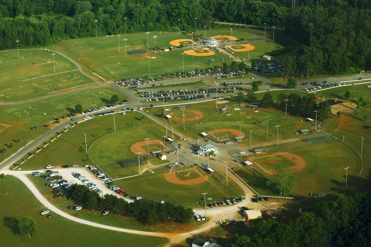
Central west Madison along Mill Creek, home to Palmer Park and two greenways, is zoned almost entirely for James Clemens High. ZIP 35758: $376,539.
Last checked Oct. 17, 2026. Sources: the City of Madison’s Madison on Track 2045 Comprehensive Plan (PDF, amended June 9, 2025), greenways and trails map and parks pages; Madison City Schools’ 2026-27 School Zone Locator; the Alabama State Department of Education’s state report card for 2025; Zillow Research; and OpenStreetMap.
The Mill Creek area is the band of neighborhoods in central west Madison that follows Mill Creek and its greenway, between Wall Triana Highway and County Line Road. It holds Palmer Park, which the plan calls one of Madison’s largest recreation complexes, Mill Creek and Heritage elementary schools and two city greenways. The city’s comprehensive plan names the Mill Creek floodplain, with Rainbow Mountain, as a natural barrier that limits road links across town.
What this means for you
- Zoned high school: James Clemens High, 11306 County Line Road (2025 state report card: 88).
- Home value: $376,539 in ZIP 35758 in September 2026, according to the Zillow Home Value Index.
- Nearest interstate exit: I-565 exit 9 (Madison Boulevard and Wall Triana Highway), about 2.7 miles by road.
Part of our Madison neighborhoods guide.
Where it is
For this guide the area runs west from Wall Triana Highway and Sullivan Street to County Line Road, and north from Madison Boulevard and Palmer Road to Browns Ferry Road. Mill Road crosses it east and west, and Balch Road and Mose Chapel Road north and south. It is in Madison County and ZIP code 35758; County Line Road is the line with Limestone County. OpenStreetMap names Maplewood as a place near its east end.
The plan says Madison’s neighborhoods grew in a pattern of large blocks and cul-de-sacs with few links between them, more so as the city spread north and west, which concentrates traffic on a few connector streets.
Schools
Scores are each school’s overall score on the 2025 state report card (the 2024-25 school year).
| Level | School | Address | 2025 score |
|---|---|---|---|
| Elementary | Heritage Elementary | 11775 County Line Road | 99 |
| Elementary | Mill Creek Elementary | 847 Mill Road | 97 |
| Elementary | Madison Elementary | 17 College St. | 97 |
| Middle | Journey Middle | 217 Celtic Drive | 93 |
| Middle | Liberty Middle | 281 Dock Murphy Drive | 93 |
| High | James Clemens High | 11306 County Line Road | 88 |
In Madison City Schools’ 2026-27 zone layer, almost all of this area is zoned for James Clemens High; one small study area goes to Bob Jones High (86). About three-quarters is zoned for Journey Middle and the rest for Liberty Middle. The elementary school is split: Heritage Elementary for the largest share, then Mill Creek Elementary and Madison Elementary. Mill Creek and Heritage elementary schools stand inside the area. Check one address with the School Zone Locator or call the Central Office, 256-464-8370. More in our schools guide.
Home values
The typical home value in ZIP code 35758 was $376,539 in September 2026, up 1.4% from $371,281 in September 2025, according to the Zillow Home Value Index. The index is a modeled typical value for the middle third of homes, not a sale price, and 35758 covers most of Madison, so it is not a figure for this area alone. The City of Madison figure was $376,486, up 0.9%. More in our home prices and property taxes guides.
Parks and trails
- Palmer Park, 574 Palmer Road: about 93 acres with 13 youth baseball fields, six softball fields and an adult softball field, nine soccer fields, two football fields, four pavilions and an accessible playground, according to the comprehensive plan. Fireworks are banned there.
- Sunshine Oaks, 228 Mose Chapel Road: an 18-hole disc golf course, playground and three pavilions on the Bradford Creek Greenway, according to the city.
- Mill Creek Greenway: 1.5 miles, with parking at Mill Road and Balch Road, at Browns Ferry Road and Balch Road and at the end of Spotted Fawn Road, according to the city’s trail map; 256-631-8235.
- Bradford Creek Greenway: 2.3 miles, with parking at 937 Mill Road, 556 Palmer Road and the Heritage Elementary lot.
- Mill Creek Dog Park, 38 Balch Road: 1.43 fenced acres with a separate area for dogs 25 pounds and under, according to the city.
- Neighborhood parks from the plan’s inventory: Fieldcrest Park, 120 Arrowhead Trail; Governors Park, 101 Bibb Drive; Madison Trace Park, 127 Progress Lane; and Rickwood Park, 413 Mose Chapel Road.
More in our walking and biking trails and parks and trails guides.
Getting around
- Interstate: I-565 exit 9 (Madison Boulevard and Wall Triana Highway), about 2.7 miles by road from Mill Road at Mill Creek Elementary; exit 7 (County Line Road) is about 3.4 miles.
- City Hall: about 1.7 miles by road to 100 Hughes Road.
- Airport: about 6.3 miles by road to Huntsville International Airport.
Distances are measured on the OpenStreetMap road network with the OSRM routing engine; they are distances, not drive times. Madison has no fixed-route city bus; see our getting around guide.
Groceries and everyday stores
OpenStreetMap maps no supermarket inside the area. The nearest, from OpenStreetMap:
- Kroger, 4579 Wall Triana Highway, at the northeast corner.
- Publix, 350 Hughes Road.
- Walmart Supercenter, 8650 Madison Blvd., to the south.
How we drew this area
The area follows Mill Creek, the Mill Creek and Bradford Creek greenways on the city’s trail map and the roads that bound them: Wall Triana Highway, County Line Road, Madison Boulevard, Palmer Road and Browns Ferry Road, checked Oct. 17, 2026. School zones come from Madison City Schools’ 2026-27 zone layer. Place and store locations are © OpenStreetMap contributors.
Frequently asked questions
What high school is the Mill Creek area of Madison zoned for?
Almost all of it is zoned for James Clemens High (88 on the 2025 state report card) in Madison City Schools’ 2026-27 locator. Middle schools are Journey or Liberty, both 93.
Where do you park for the Mill Creek Greenway in Madison?
At Mill Road and Balch Road, at Browns Ferry Road and Balch Road, or at the end of Spotted Fawn Road, according to the city’s greenways and trails map. The greenway is 1.5 miles long.
What is at Palmer Park in Madison?
About 93 acres at 574 Palmer Road with 13 youth baseball fields, six softball fields plus an adult field, nine soccer fields, two football fields, four pavilions and an accessible playground, according to the city’s comprehensive plan.
Is the Mill Creek area of Madison a good place to live?
Here are the facts. It is a central west Madison area with Palmer Park and the Mill Creek and Bradford Creek greenways, zoned for James Clemens High (88 on the 2025 state report card); the typical home value in ZIP 35758 was $376,539 in September 2026, according to Zillow.
Have your say