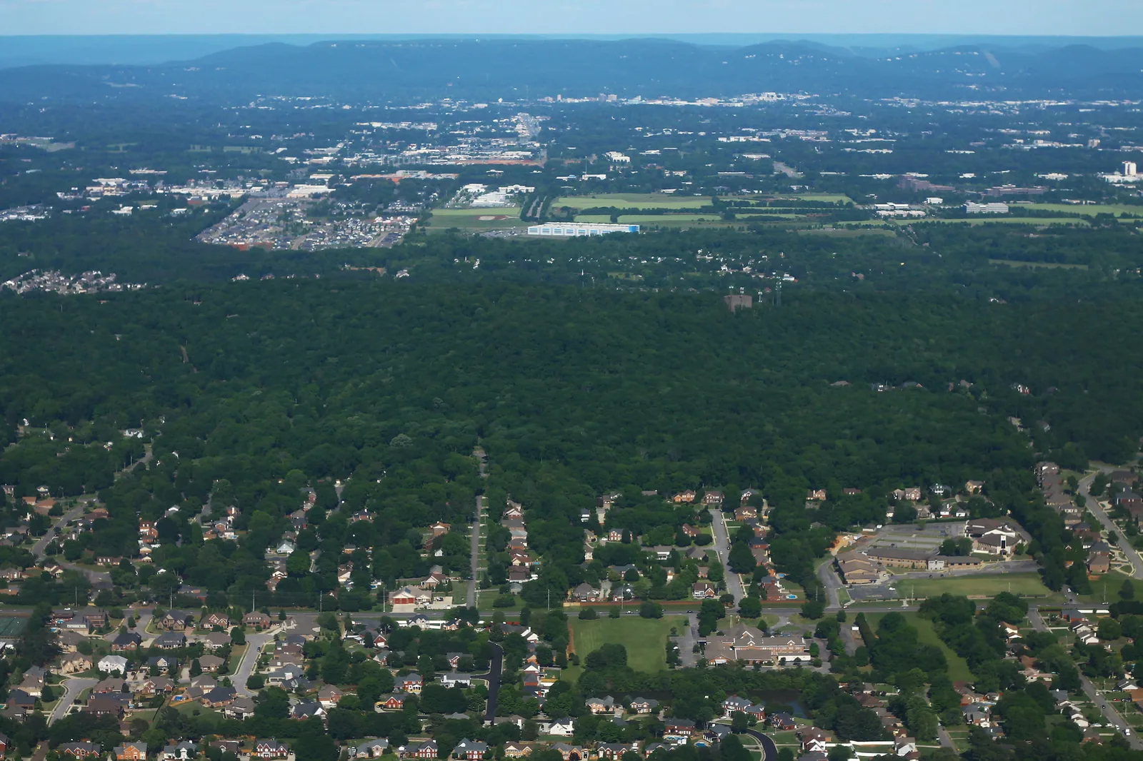
Northeast Madison around Rainbow Mountain is zoned mostly for Rainbow Elementary, Discovery Middle and Bob Jones High. ZIP 35758: $376,539.
Last checked Oct. 17, 2026. Sources: the City of Madison’s Madison on Track 2045 Comprehensive Plan (PDF, amended June 9, 2025), greenways and trails map and Greenways and Trails page; Madison City Schools’ 2026-27 School Zone Locator; the Alabama State Department of Education’s state report card for 2025; Zillow Research; the Census Bureau; and OpenStreetMap.
Northeast Madison is built around Rainbow Mountain, one of the two hills that locals call mountains. The city’s comprehensive plan puts the mountain about 465 feet above the railroad benchmark near downtown, which sits at 675 feet. The mountain holds the hiking trails of the Rainbow Mountain Preserve, with homes on the streets around it, Rainbow Elementary to the north and the stores on U.S. 72 at the city’s northern edge.
What this means for you
- Zoned high school: Bob Jones High, 650 Hughes Road (2025 state report card: 86).
- Home value: $376,539 in ZIP 35758 in September 2026, according to the Zillow Home Value Index.
- Nearest interstate exit: I-565 exit 9 (Madison Boulevard and Wall Triana Highway), about 5.9 miles by road; U.S. 72 runs along the north edge.
Part of our Madison neighborhoods guide.
Where it is
For this guide the area runs from Hughes Road east to the Huntsville line and from Eastview Drive north to U.S. 72, with the mountain in the middle. It is in Madison County; the Census Bureau places it in ZIP code 35758. OpenStreetMap names several places here, among them Rainbow, Stone Ridge, Indian Hills and Rainbow Gap Estates, and maps the peak and the preserve’s loop trail.
The comprehensive plan says the residential areas to the northeast of Rainbow Mountain are among the parts of Madison where fire and rescue crews consistently miss the six-minute response goal, mostly because of the limited road network and traffic. It says U.S. 72 carries more than 40,000 vehicles a day, with high delays from congestion. The plan also identifies a need for about 30 more acres at the preserve.
Schools
Scores are each school’s overall score on the 2025 state report card (the 2024-25 school year).
| Level | School | Address | 2025 score |
|---|---|---|---|
| Elementary | Rainbow Elementary | 50 Nance Road | 97 |
| Elementary | Horizon Elementary | 7855 Old Madison Pike | 98 |
| Middle | Discovery Middle | 1304 Hughes Road | 94 |
| High | Bob Jones High | 650 Hughes Road | 86 |
In Madison City Schools’ 2026-27 zone layer, every study area in this part of Madison is zoned for Discovery Middle and Bob Jones High. About four-fifths of the land is zoned for Rainbow Elementary, which stands inside the area on Nance Road; most of the rest goes to Horizon Elementary, and a small piece to Midtown Elementary (96). Discovery Middle is on Hughes Road at the area’s west edge. Check one address with the School Zone Locator or call the Central Office, 256-464-8370. More in our schools guide.
Home values
The typical home value in ZIP code 35758 was $376,539 in September 2026, up 1.4% from $371,281 in September 2025, according to the Zillow Home Value Index. The index is a modeled typical value for the middle third of homes, not a sale price, and 35758 covers most of Madison, so it is not a figure for this area alone. The City of Madison figure was $376,486, up 0.9%. More in our home prices and property taxes guides.
Parks and trails
- Rainbow Mountain Preserve: 3.96 miles of hiking trails, with the main trailhead, pavilion, kiosk and portable restroom at 230 Stoneway Trail and a second entrance off Kensington Drive, according to the city’s trail map. The 1.5-mile loop follows the rocky cliff ridge past formations such as Balance Rock, the city says. The Land Trust of North Alabama runs it; 256-534-5263. Trails are open dawn to dusk.
- Rainbow Mountain Park, 274 Carter Road, and Stoneridge Park, 195 Stoneway Trail: city neighborhood parks listed in the comprehensive plan’s park inventory.
- Indian Creek Greenway: along the Huntsville line to the east, 3.6 miles of trails, with parking at 336 Harvestwood Court, according to the city’s map. Huntsville maintains it; 256-564-8026.
More in our walking and biking trails and parks and trails guides.
Getting around
- Interstate: I-565 exit 9 (Madison Boulevard and Wall Triana Highway), about 5.9 miles by road from the middle of the area. U.S. 72 runs east to Huntsville along the north edge.
- City Hall: about 3.9 miles by road to 100 Hughes Road.
- Airport: about 9.2 miles by road to Huntsville International Airport.
Distances are measured on the OpenStreetMap road network with the OSRM routing engine; they are distances, not drive times. Madison has no fixed-route city bus; see our getting around guide.
Groceries and everyday stores
From OpenStreetMap, on or near U.S. 72 along the north edge:
- Sprouts Farmers Market, 7504 U.S. Highway 72 West.
- Aldi, 7676 Highway 72 West.
- Kroger with a pharmacy, 7090 University Drive NW, just over the line in Huntsville.
- Walgreens, 7813 Hughes Road.
How we drew this area
The area is the land around Rainbow Mountain that OpenStreetMap maps as the peak, the preserve and the named places Rainbow and Stone Ridge, bounded by Hughes Road, Eastview Drive, U.S. 72 and the Huntsville line, checked Oct. 17, 2026. The comprehensive plan names Rainbow Mountain and the preserve. School zones come from Madison City Schools’ 2026-27 zone layer. Place and store locations are © OpenStreetMap contributors.
Frequently asked questions
What schools is the Rainbow Mountain area of Madison zoned for?
Mostly Rainbow Elementary, Discovery Middle and Bob Jones High in Madison City Schools’ 2026-27 locator. They scored 97, 94 and 86 on the 2025 state report card. Some streets go to Horizon Elementary.
How tall is Rainbow Mountain in Madison?
About 465 feet above the city’s Norfolk Southern railroad benchmark near downtown, which sits at 675 feet, according to Madison’s comprehensive plan.
Where do you park for Rainbow Mountain Preserve?
The main trailhead is at 230 Stoneway Trail, with a second entrance off Kensington Drive, according to the city’s trail map. The Land Trust of North Alabama runs the preserve; 256-534-5263.
Is the Rainbow Mountain area of Madison a good place to live?
Here are the facts. It is a northeast Madison area around a wooded nature preserve, zoned for Bob Jones High (86 on the 2025 state report card); the typical home value in ZIP 35758 was $376,539 in September 2026, according to Zillow.
Have your say