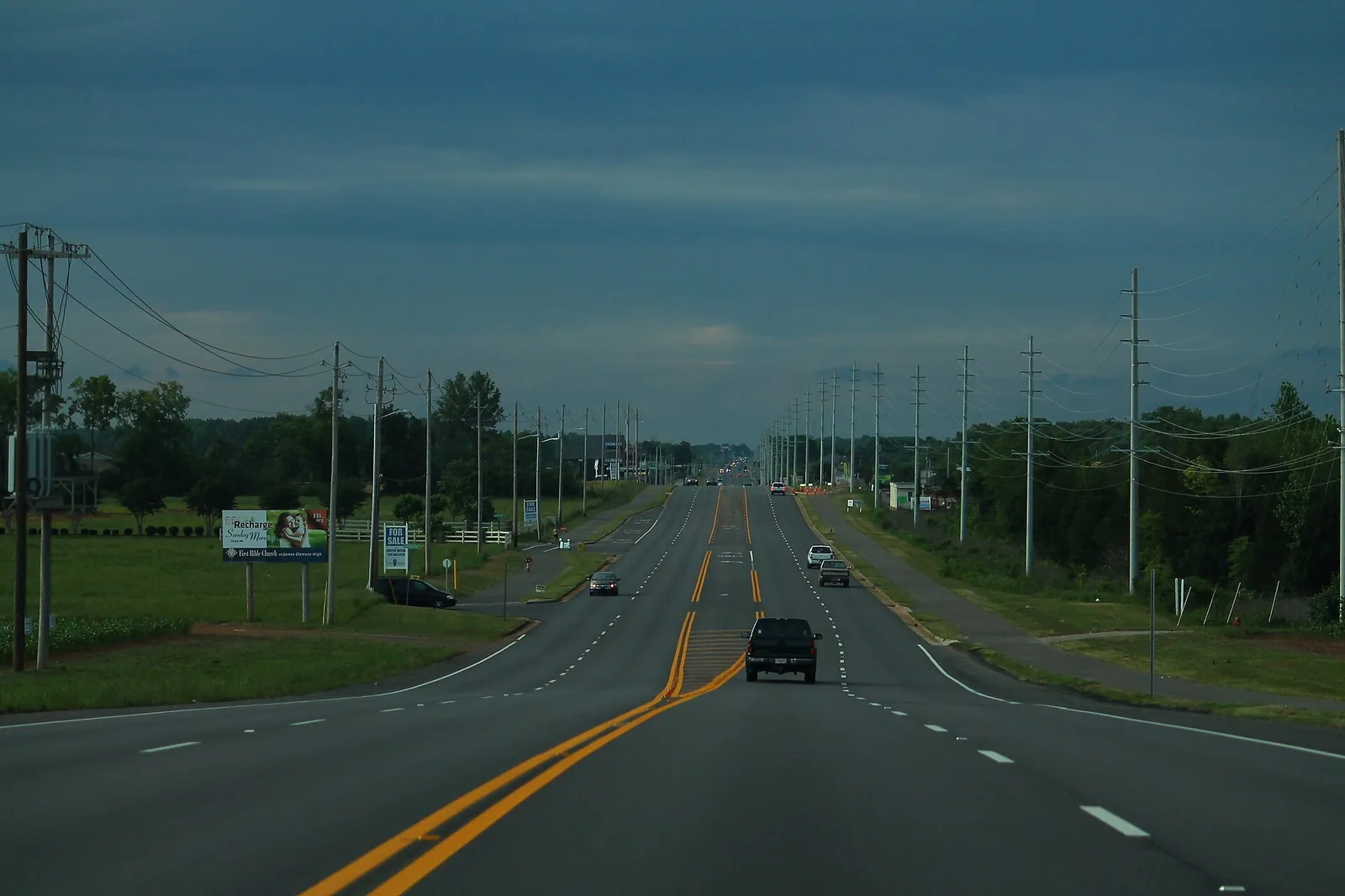
Madison's West Side, in Limestone County west of County Line Road, is zoned for James Clemens High. ZIP 35756 was $388,014 in September 2026.
Last checked Oct. 17, 2026. Sources: the City of Madison’s Madison on Track 2045 Comprehensive Plan (PDF, amended June 9, 2025), West Side Master Plan page and greenways and trails map; Madison City Schools’ 2026-27 School Zone Locator; the Alabama State Department of Education’s state report card for 2025; the Alabama Department of Revenue’s 2025 millage table (PDF); Zillow Research; the Census Bureau; and OpenStreetMap.
Madison’s West Side is the part of the city in Limestone County, west of County Line Road. The city’s comprehensive plan names it, with Town Madison, among the main places for future growth, and says residents again picked this Western Growth Area as the place most suited to more homes and mixed-use development, and says large farm tracts and unincorporated land still make up about half of the Limestone County part of Madison and its edges. James Clemens High stands here, on County Line Road.
What this means for you
- Zoned high school: James Clemens High, 11306 County Line Road (2025 state report card: 88).
- Home value: $388,014 in ZIP 35756 in September 2026, according to the Zillow Home Value Index.
- Nearest interstate exit: I-565 exit 7 (County Line Road and Madison Boulevard), about 4.6 miles by road.
Part of our Madison neighborhoods guide.
Where it is
The West Side runs west from County Line Road, the Madison County-Limestone County line, along Huntsville-Browns Ferry Road, Segers Road, Powell Road and Hardiman Road. The Census Bureau places it in ZIP code 35756. OpenStreetMap names Oakland and Burgreen Gin as places here. City limits are patchy: unincorporated county land sits between pieces of the city, so check the taxing jurisdiction for any parcel.
The plan points growth to the Huntsville-Browns Ferry Road corridor and land next to Segers Road, and to three spots on County Line Road: Huntsville-Browns Ferry Road, northeast of Madison Boulevard, and south of Hardiman Road, where apartment building was under way. It cites The Village at Oakland Springs as Madison’s example of a walkable mixed-use neighborhood. The 2016 West Side Master Plan guided land use here until the new plan replaced it in February 2025.
Services differ from the rest of town. The plan says Athens Utilities and the Limestone County Water and Sewer Authority serve properties only on the West Side, and it flags concerns about electrical capacity as the area grows. It also says fire crews struggle to reach the southwest corner within the six-minute goal and that another fire station is needed there.
Schools
Scores are each school’s overall score on the 2025 state report card (the 2024-25 school year).
| Level | School | Address | 2025 score |
|---|---|---|---|
| Elementary | Russell Branch Elementary (new) | West Side | No score yet |
| Elementary | Heritage Elementary | 11775 County Line Road | 99 |
| Elementary | Mill Creek Elementary | 847 Mill Road | 97 |
| Middle | Liberty Middle | 281 Dock Murphy Drive | 93 |
| Middle | Journey Middle | 217 Celtic Drive | 93 |
| High | James Clemens High | 11306 County Line Road | 88 |
Homes inside the city on the Limestone side go to Madison City Schools, not Limestone County Schools. In the district’s 2026-27 zone layer, every assigned study area here is zoned for James Clemens High. Russell Branch Elementary, the district’s newest school, takes the largest share, in the middle of the West Side; the strip along County Line Road goes to Heritage Elementary, or Mill Creek Elementary at the south end. Most of the area is zoned for Liberty Middle; the south end goes to Journey Middle. About a quarter of the mapped land, in the far west and northwest, carries no assignment in the layer, so ask the district about any address there. Check with the School Zone Locator or call the Central Office, 256-464-8370. More in our schools guide.
Home values and taxes
The typical home value in ZIP code 35756 was $388,014 in September 2026, almost unchanged (down 0.1%) from $388,463 in September 2025, according to the Zillow Home Value Index. The index is a modeled typical value for the middle third of homes, not a sale price. Zillow files 35756 under Madison, but the ZIP also covers unincorporated Limestone County. The City of Madison figure was $376,486, up 0.9%.
The state’s 2025 millage table puts City of Madison property in Limestone County at 72.0 mills: 6.5 state, 13.5 county, 5.5 school and 46.5 city, against 69.5 on the Madison County side. Bills come from the Limestone County Revenue Commission, 100 S. Clinton St., Athens; 256-233-6433. More in our home prices and property taxes guides.
Parks and trails
- Hardiman Place Park, 113 Beerli Drive: a city neighborhood park listed in the comprehensive plan.
- Oakland Spring Branch Greenway: the first greenway in western Madison; the plan lists an extension from Powell Road to Huntsville-Browns Ferry Road as a priority one project.
- Beaverdam Swamp Boardwalk: 1.1 miles in Wheeler National Wildlife Refuge on Madison’s southwest edge, with parking at 12001 Alabama Highway 20, according to the city’s trail map.
The city secured 23 donated acres in 2023 for its first community park on the West Side, and the plan lists a recreation center for the west side among residents’ wishes. More in our parks and trails guide.
Getting around
- Interstate: I-565 exit 7 (County Line Road and Madison Boulevard), about 4.6 miles by road from the middle of the West Side near Russell Branch Elementary.
- City Hall: about 4.7 miles by road to 100 Hughes Road.
- Airport: about 7.4 miles by road to Huntsville International Airport.
Distances are measured on the OpenStreetMap road network with the OSRM routing engine; they are distances, not drive times. Madison has no fixed-route city bus; see our getting around guide.
Groceries and everyday stores
From OpenStreetMap, at County Line Road and Gillespie Road:
- Publix with a pharmacy, 12070 County Line Road.
- Walgreens, 12010 County Line Road.
How we drew this area
The area is the part of Madison west of County Line Road, which the comprehensive plan calls the Western Growth Area and the Limestone County portion of Madison, checked Oct. 17, 2026. School zones come from Madison City Schools’ 2026-27 zone layer. Place and store locations are © OpenStreetMap contributors.
Frequently asked questions
Is part of Madison, Alabama, in Limestone County?
Yes. The part of the city west of County Line Road is in Limestone County. Property tax there is billed by the Limestone County Revenue Commission in Athens, at 72.0 mills for the 2025 tax year, against 69.5 mills on the Madison County side.
What schools does Madison’s West Side go to?
Madison City Schools, the same as the rest of the city. The 2026-27 locator zones the zoned parts for James Clemens High (88 on the 2025 state report card), mostly Liberty Middle (93), and Russell Branch, Heritage or Mill Creek elementary.
What ZIP code is the Limestone County side of Madison?
Mostly 35756. Zillow put the typical home value in 35756 at $388,014 in September 2026, about the same as a year earlier.
Is Madison’s West Side a good place to live?
Here are the facts. The West Side is Madison’s Limestone County growth area, zoned for James Clemens High (88 on the 2025 state report card), taxed at 72.0 mills; the typical home value in ZIP 35756 was $388,014 in September 2026, according to Zillow.
Have your say